TechnoServe Labs is using satellite, aerial and drone imagery – coupled with TechnoServe ground truth data and machine learning – to improve how we manage and report on our programs.
Geospatial Technology
Mapping smallholder cashew plantations to inform sustainable tree crop expansion in Benin
The University of Minnesota and TechnoServe published a research paper “Mapping smallholder cashew plantations to inform sustainable tree crop expansion in Benin” in Remote Sensing of Environment, the leading peer-reviewed journal on remote sensing technologies and applications.

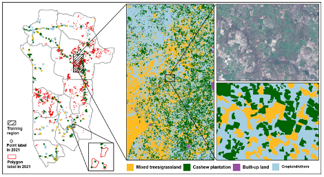
The work was the culmination of three years of joint work between TechnoServe Labs, the USDA BeninCajù program and the University of Minnesota to develop a machine learning algorithm that interprets satellite imagery to identify cashew growing areas in Benin with 85% accuracy.

University of Minnesota presented the UMinn/TNS research at the American Geospatial Union –
An interactive dashboard for policy makers
TechnoServe Labs and the University of Minnesota created a dashboard to map cashew growing areas in Benin, using satellite imagery and machine learning algorithms. The dashboard will help field teams improve operations and policy makers make better decisions.
Using the mapping algorithm, TechnoServe Labs engineers and interns from Carnegie Mellon University – Africa in Kigali, Rwanda and CERCO Group and Epitech in Cotonou, Benin created an interactive geospatial dashboard showing smallholder cashew growing areas. The dashboard will help field teams improve operations and policy makers make better decisions.

Expanding cashew mapping work in West Africa
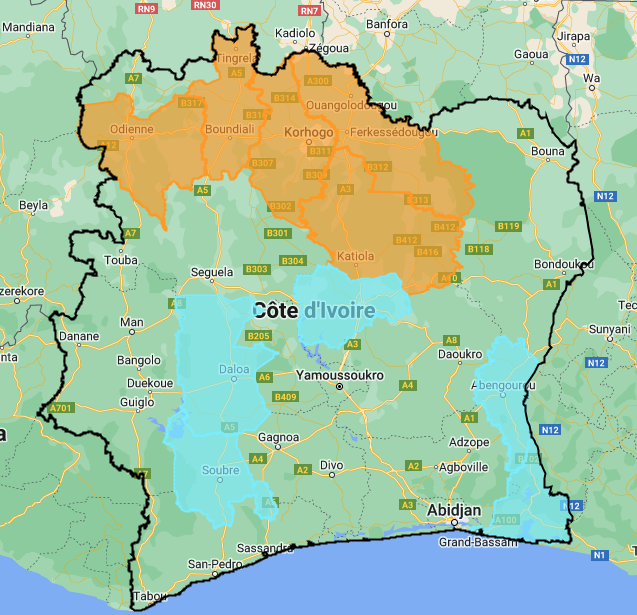
Cashew mapping is being expanded to Côte d’Ivoire, Nigeria and Senegal.
We plan to create a map of cashew for the entire African continent and to apply this research in the areas of carbon sequestration, deforestation monitoring and traceability. The dashboard will help field teams improve operations and policy makers make better decisions.
The University of Minnesota is working with Professor Kyle Davis at the University of Delaware to map cashew farms in Nigeria. Prof Davis and the Nigerian National Space Research and Development Agency (NASRDA) used the NASA Harvest Helmet Cam data collection model for large scale ground data collection in Nigeria.
We shared TechnoServe ground data collection processes with a team from the Kansas State University Sustainable Intensification Innovation Lab (SIIL), funded by USAID Feed for Future to capture field data in Senegal.
Expanding the work to other smallholder tree crops
Finally, we are expanding our cashew smallholder mapping work to other tree crops. PhD candidate Angela Tsao of the Stanford Center on Food Security and the Environment is working with TechnoServe Labs to map mango and aquaculture sites in Côte d’Ivoire, adapting the cashew mapping algorithm for other tree species.

